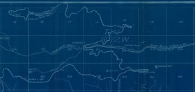
A good chunk of his maps are available digitally from the University of Colorado, although finding them can be a bit tricky. The CU maps mostly feature mining claims in Boulder county, they are blueprints and typically only show major geographical features such as streams, creeks, rivers and mountain summits. The railroad line is not typically featured on these maps but combined with a couple of other maps you can get a good idea of how the claims around Sunset intersect with the C&N. I have taken a look at the dates on the maps and most of them are after the C&N (or DB&W) was dismantled so that could explain why you don't see the railroad on them.
There aren't nearly as many claims in the area around Sunset as there are around some of the other locations along the C&N. Enough to justify a couple of mines but not much more than that. Salina, Ward and Eldora have dozens of overlapping claims.
Here are the two maps that I found for Sunset.
 |
| This is a snip from a larger county map. Unfortunately it doesn't include Ward which is just off the top of the map. You can see from this map why the C&N was also known as the Whiplash Route. |


No comments:
Post a Comment